


Tour Gioberney par le lac Lauzon et le refuge du pigonnier

Spinnaker
User
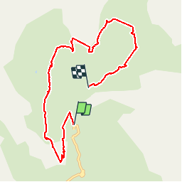

Length
8.4 km

Max alt
2451 m

Uphill gradient
864 m
Km-Effort
19.6 km

Min alt
1634 m

Downhill gradient
773 m
Boucle
No
Creation date :
2019-08-03 06:41:11.858
Updated on :
2019-08-03 17:28:11.672
4h30
Difficulty : Medium

FREE GPS app for hiking
 SityTrail
IGN / Geographical institutes
SityTrail Plus
The world is yours!
About
Trail Walking of 8.4 km to be discovered at Provence-Alpes-Côte d'Azur, Hautes-Alpes, La Chapelle-en-Valgaudémar. This trail is proposed by Spinnaker.
Positioning
Country:
France
Region :
Provence-Alpes-Côte d'Azur
Department/Province :
Hautes-Alpes
Municipality :
La Chapelle-en-Valgaudémar
Location:
Unknown
Start:(Dec)
Start:(UTM)
285121 ; 4968966 (32T) N.
Comments